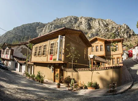
Fındıklı, a neighbourhood of the Amasya Merkez district, has a past quite different from that of the neighbourhoods along the Yeşilırmak that form the historic core of the city. For many years it was recorded as a village in its own right, and in 2013 it gained the status of an independent neighbourhood within the boundaries of Amasya Municipality. Open sources contain no detailed documentation of the origin of its name, the date of its founding or the village's records in the Ottoman period. Hüseyin Hüsameddin Yasar's Amasya Tarihi and Osman Fevzi Olcay's Amasya Hâtıraları do not mention the village by name; the phrase "a waterside mansion at Fındıklı" that occurs in Hüsameddin's texts refers to the Fındıklı on the Bosphorus in Istanbul. An account of the neighbourhood must therefore be a careful one, keeping what is documented apart from what cannot be.
Location and Surroundings
Fındıklı is one of the neighbourhoods of the Merkez district of Amasya Province, and Boğazköy, Duruca, Aydınlık, Bağlarüstü, Değirmendere and Göllü Bağları are counted among its neighbours. Most of these names point to settlements of village or vineyard origin, and Fındıklı is better thought of within this rural surround than within the old core of the city with its stone buildings. One compilation site gives its area as about 3.41 km2; because this does not come from an official source, the figure should not be treated as certain. The historic neighbourhoods in the centre of Amasya are small settlements squeezed into the narrow strip of the Yeşilırmak valley, between the cliffs and the river. That Fındıklı is spread over a comparatively large area suggests that it derives less from the market and housing fabric of the riverside than from a village layout in the part of the valley that opens onto the countryside. This inference also fits with the settlement having been recorded as a village for a long time.
The Origin of the Name and Places with the Same Name
Fındıklı is a name found in a great many settlements in Turkey. The district in Rize, the quarter on the Bosphorus in Istanbul, and villages in Ordu, Trabzon and Çanakkale all bear it, and their histories are independent of one another. No document specific to the neighbourhood explains from which vegetation or which person Fındıklı in Amasya took its name. On the usual reading the name describes a place with hazel trees, but this is a guess.
Within the borders of Amasya Province the name Fındıklı has not been limited to this neighbourhood alone. According to the table in Bekir Başalan's study of renamed settlements in Amasya, the former name of Direkli, a village now attached to the Merkez district, appears as "Fındıklı/Göndes". In the same study, when the villages of the centre that were later converted into neighbourhoods are listed, Fındıklı is named together with Boğazköy, Helvacı, Karasenir, Orman Bağları, Saraycık, Yazıbağları, Yeniköy and Yeşilyenice. The former name of Direkli and today's Fındıklı Neighbourhood are separate places and should not be confused in the sources. The Merkez district also has a village called Özfındıklı today; no document has been seen on the relationship between that settlement and the neighbourhood.
From Village to Neighbourhood
The most marked change in Fındıklı's administrative status took place in 2013. A news report dated August 2013 states that, together with the attachment of Yeşilyenice Municipality to Amasya Municipality under Law No. 6360, the villages of Fındıklı and Sarılar were made independent neighbourhoods under Article 8 of the Municipalities Law No. 5393. It adds that the decision was approved by the Ministry of Interior's General Directorate of Local Administrations and would take effect with the first local elections; the change thus came into force with the March 2014 elections. According to the report, the decision was communicated to many bodies, including the Amasya Governorship, the Special Provincial Administration and the population directorate.
This date is also consistent with the course of the neighbourhood's population over the years. A population shown as 500 in 2013 rises to 744 in 2014. The sources do not explain this jump; a difference in how the figures were recorded between the year the population was counted as a village and the year it was counted as a neighbourhood is a possible explanation, but no document confirms it. That Sarılar went through the same process shows that Fındıklı was not an exception on its own. Villages near the city centre were brought within the municipal boundaries and converted into neighbourhoods at this time, so that the administrative map of Amasya widened to take in the rural settlements around the city.
Earlier Records
The earliest document found under the name Fındıklı for the post-Ottoman period is a Fındıklı listed in a 1911 register as a Greek village of 451 inhabitants attached to the Metropolitanate of Amasya. An entry in a place-name inventory says that this village should be the Fındıklı in Amasya Merkez, that is, a settlement with an Orthodox Greek population at the beginning of the twentieth century; but the entry itself is given with the qualifier "should be", and it has not been confirmed by a separate document. A study on the population exchange records that about 25,000 Greeks lived in Amasya before the First World War, that they left the region with the 1923 population exchange, and that the population of the province changed in the Republican period into a largely Turkish and Muslim one. There is no record specific to the neighbourhood on the stage of this process at which Fındıklı changed its population, or on which groups settled in the village.
The same inventory also links Fındıklı with an endowment record under the name "Cemaleddin Bey's Yazarı Endowment". It cannot be understood from the sources whether this information belongs to the Fındıklı in Amasya or to another settlement of the same name; the detail has therefore been noted as a lead to be verified rather than as a fact.
Its Place in the History of Amasya
Although the neighbourhood's own past is known only in a limited way, the history of the geography in which it lies is documented in detail. According to the history published by the Amasya Provincial Directorate of Culture and Tourism, the pottery, weapon remains and architectural traces found in the mounds show that the city's past reaches back to the Neolithic and Chalcolithic ages. Settlement around Amasya is known to have been dense in the Early Bronze Age; the Yassı Höyük (Oluz Höyük) and Kayadüzü mounds in the Merkez district are counted among the examples of this period. In the Middle Bronze Age the region lay within the borders of the Hatti civilisation, after which the Hittites became dominant; the bronze statuette of the Storm God Teshub, found in the Doğantepe (Zara) township in the Merkez district and dated to 1400-1200 BC, is today in the Amasya Museum. In the following centuries the Phrygians, Cimmerians, Medes and Persians in turn ruled the region, and in 301 BC the Kingdom of Pontus, founded by Mithridates Ktistes, made Amasya its capital. In 63 BC the region came under Roman rule, and after Malazgirt (1071) it passed to the Danishmendids and, from 1175, to the Seljuks. In the Ottoman period Amasya was a sanjak in which princes served and the centre of the Province of Rum, and Mustafa Kemal Pasha came to the city on 12 June 1919.
We have no record of what role Fındıklı played in any of these periods, and to attribute these events to the neighbourhood would be to borrow the past of other settlements. The history of the farmland, gardens and roads within the neighbourhood's boundaries has been committed to writing far less than that of the castle, the palace or the külliye; this lack is not particular to one neighbourhood.
Population
The figures on the neighbourhood's population come from a site that compiles address-based population records; the site does not guarantee the accuracy of its information. According to this compilation the population of the neighbourhood is as follows:
- 2013: 500
- 2014: 744
- 2015: 773
- 2016: 745
- 2017: 727
- 2018: 734
- 2019: 647
According to the results of the 2021 address-based population registration system, the population of the neighbourhood is 524. A general decline is visible after 2015; its cause is not explained in the sources, so it has not been attributed to a factor such as migration or ageing. The figures show the neighbourhood to be a small settlement, far from any crowd.
Fındıklı Today
The known public buildings that carry Fındıklı's name today are gathered around the TOKİ Housing Estate within the neighbourhood's boundaries. On Eraslan Street, this estate contains the Fındıklı TOKİ Primary School and Middle School, the Day Care, Rehabilitation and Family Counselling Centre attached to the Provincial Directorate of Family and Social Services, and the Fındıklı Neighbourhood TOKİ Housing Estate Mosque (mescit). A school directory gives the number of pupils as 23; this figure belongs to a compilation whose currency has not been verified. The present appearance of the neighbourhood is therefore set by the mass housing and the service buildings around it. No mosque, fountain or listed building surviving from the old village fabric has been found in the sources; establishing whether such buildings exist would require the records of Amasya Municipality and the General Directorate of Foundations, information from the muhtar's office, and fieldwork.
Chronology
1911: A Fındıklı recorded as a Greek village of 451 inhabitants attached to the Metropolitanate of Amasya; a place-name inventory states, with the qualifier "should be", that it is the Fındıklı in Amasya Merkez.
1923: The Greek-Turkish population exchange; the Greek population of Amasya leaves the region (there is no record specific to Fındıklı).
August 2013: The making of the villages of Fındıklı and Sarılar into independent neighbourhoods under Article 8 of Law No. 5393 is announced in the news.
2014: The decision takes effect with the first local elections; the compilations show a population of 744.
2021: According to the address-based population record, the neighbourhood's population is 524.
Sources
Academic studies
- Bekir Başalan, "Amasya İlinde İsimleri Değiştirilen Yerleşim Yeri Adları Üzerine Bir İnceleme", DergiPark (former name of Direkli; villages converted into neighbourhoods)
- "1923 Tarihli Türk-Rum Nüfus Mübadelesinin Amasya'nın Demografik Yapısına Etkisi", Ordu Üniversitesi Sosyal Bilimler Araştırmaları Dergisi
Official sources
- Amasya İl Kültür ve Turizm Müdürlüğü, "Tarihçe", T.C. Kültür ve Turizm Bakanlığı (amasya.ktb.gov.tr)
- Ministry of Family and Social Services Amasya Provincial Directorate, "Kuruluşlarımız" (Eraslan Street, TOKİ Housing Estate)
Other sources
- "Yeşilyenice Beldesi Amasya'ya Mahalle Oldu", Haberler.com, 6 August 2013 (the villages of Fındıklı and Sarılar becoming independent neighbourhoods)
- Nişanyan Yeradları, "Amasya Merkez settlements" (1911 Greek village record)
- nufusu.com, "Merkez Mahalleleri Nüfusu Amasya" (TÜİK/ADNKS compilation, 2013-2019)
- Wikipedia (English), "Fındıklı, Amasya" (2021 population)
- trharitasi.com, "Amasya Merkez map" (area, compilation site)
Online sources
- https://amasya.ktb.gov.tr/TR-59475/tarihce.html
- https://www.haberler.com/yerel/yesilyenice-beldesi-amasya-ya-mahalle-oldu-4915934-haberi/
- https://dergipark.org.tr/tr/download/article-file/4249891
- https://nisanyanyeradlari.com/?t=Amasya_m&u=1&ua=0&y=
- https://www.nufusu.com/merkez-amasya-mahalleleri-nufusu
- https://en.wikipedia.org/wiki/Fındıklı