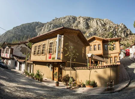
Yüzevler is one of those Amasya neighbourhoods that stand at the edge of the city's great narratives, and few written documents concern it. Its name suggests a settlement of about a hundred houses, and the suggestion is not misplaced: a recent master's thesis records that the name comes from a hundred disaster-relief houses built in the 1940s on ground left empty by fire. The neighbourhood's story is therefore tied less to the Ottoman centuries than to the catastrophes of the twentieth century; the fire of 1915, the earthquake of 1939 and the flood of 1948 prepared the ground for today's Yüzevler in the city's centre south of the Yeşilırmak. Its present identity is shaped by blocks of flats built wall to wall, shops on their ground floors, a riverside walkway, a woodworking studio and a population that has been falling for years. Only an indirect note in an archaeological rescue-excavation report sheds light on older layers. Points that cannot be documented are left as unknowns.
Origin of the Name
The word "Yüzevler" is formed from the Turkish words for "hundred" and "house" and means, grammatically, "a hundred houses". Selçuk Topçu's master's thesis, written at Çankaya University in 2022 on the twentieth-century transformation of the conservation area south of the Yeşilırmak, states the source of the name plainly: in the area affected by the fire of 1915, after the Erzincan earthquake, "a hundred disaster houses were built under the name Yüzevler". Another section of the thesis notes that construction of these houses was completed in 1948 and refers to them as "the disaster houses, that is, Yüzevler". The name thus appears less as an old place-name acquired by a quarter that grew of its own accord than as one derived from the number of dwellings in a housing scheme set up by the state after a disaster.
The thesis dates the earthquake to 1938 in one passage and to 1939 in another; in its own chapter on disasters it presents the quake, which badly damaged the Sultan Bayezid Mosque, the Burmalı Minaret Mosque, the Mehmed Paşa Mosque and the Büyükağa Madrasa in Amasya, as the 1939 earthquake centred on Erzincan. The same thesis also records that after the flood of 3 June 1948 the victims were settled in "the Yüzevler area". The two statements do not exclude each other: the houses may have been begun to meet the need created by the earthquake, and the victims of the flood that struck in the year of their completion may also have been housed there. Even so, no official decision or list of beneficiaries showing which institution built the houses, with what budget, and who their first residents were has been found in the course of this research.
The name "Yüzevler" does not occur in the full texts of Hüseyin Hüsâmeddîn Yasar's Amasya Tarihi. This silence is no longer surprising; the author died in February 1939, before the disaster houses that gave rise to the name existed. Nor does the name appear in Bekir Başalan's article compiling the renamed settlements of Amasya. The "Üçler Mahallesi" frequently mentioned by Hüsameddin is a separate matter: the work refers to notable families living in that quarter, graves in a mosque garden, an Üçler cemetery, the "Üçler endowment deed" and the "Üçler incident". Today Üçler is registered in central Amasya as a separate neighbourhood adjoining Yüzevler. A photograph from the 1950s reproduced in Topçu's thesis bears the caption "View of Yüzevler from Üçler Mahallesi", showing that the two settlements lay within sight of each other; the museum report mentioned below, which uses both names together, can be read as a reflection of this proximity.
From Burnt Ground to Disaster Housing
The ground on which Yüzevler was laid out is the area where the Amasya market and its adjoining quarters burned at the beginning of the twentieth century. According to a letter of 12 March 1914 from the Acting Governor of Sivas, a fire that broke out in a tobacconist's shop at Selağzı burned thirty-five shops and, driven by the wind, engulfed almost the entire quarter. A larger fire came the following year. According to a letter written on 21 July 1915 to the 10th Army Corps Command in Sivas, to which the Amasya Division Command was attached, arson fires set during the Armenian deportation affected fourteen quarters and nearly two thousand shops and houses. Because the burned houses were of timber, the destruction was all the greater, and the Ottoman domestic fabric of the area disappeared entirely.
Through the local historian Hüseyin Menç, Topçu was able to see a pre-1915 map held in the Planning Directorate of Amasya Municipality but never entered in its archive records, and he traced the extent of the fire on it. The area covered by the map reaches the Yeşilırmak, that is Ziya Paşa Boulevard, to the north and the slopes of Mount Sakarat to the south; it includes the present Şehirüstü and Fethiye neighbourhoods, and runs in the west along the line of the Sultan Bayezid Complex and today's Yüzevler Neighbourhood, and in the east along the line of the Saraçhane Mosque, the Bedesten, the Taşhan and the Burmalı Minaret Mosque. Before the fires the plots in this part of the city were laid out organically and the streets were narrow. Photographs taken in the 1940s show that the burned areas had been left as open ground and that the continuity of the townscape had been lost.
A development plan was prepared in 1945 to fill this void, but it was never put into effect. When the disaster houses were built, the pre-fire layout was likewise disregarded, and a new pattern of plots and new roads was laid out so as to connect with the other neighbourhoods. The axis of Ziya Paşa Boulevard, then the city's main artery, and the sites of the historic monuments were, however, kept as they were. The regular street grid that today sets Yüzevler apart from the surrounding neighbourhoods most probably derives from this first settlement decision, though no study has been found that compares the 1940s plot layout with the present street plan step by step.
The 1949 Aerial Photograph and the Early Years
The document that gives the closest view of Yüzevler in its first form is an aerial photograph held in the archive of the Amasya Municipality Directorate of Planning and Urbanism. Its date is uncertain in the archive record. Noting that the photograph shows the disaster houses completed but Amasya High School not yet built, and knowing that the houses were finished in 1948 and the school begun in 1950, Topçu dates the photograph to 1949. The neighbourhood itself thus became a yardstick for dating an aerial view of the city.
The photograph shows Mustafa Kemal Paşa Street, today a main artery, joining Yavuz Selim Square and ending there, its continuation not yet opened. The dense building that now lines the street is absent and there are no high-rise buildings at all; in the western part of the area scattered buildings and open plots dominate. Two photographs taken from the archive of the Central Black Sea Development Agency (OKA) are captioned in the thesis "1949 view of the Sultan Bayezid II Complex and Yüzevler" and "1949 view of Yüzevler". According to Topçu, two important axes had already formed by the time of the 1949 photograph: today's Ziya Paşa Boulevard and Mustafa Kemal Paşa Street. In the following decades Mustafa Kemal Paşa Street was extended from Yavuz Selim Square through Pirinççi Mahallesi, and Ziya Paşa Boulevard was joined to Mehmet Paşa Street to form a second axis. That both of these streets appear among Yüzevler's addresses today is a reminder that the neighbourhood was born on the newly drawn central axes of the city.
When and how the first hundred houses gave way to the present blocks of flats is unknown. The surveys of 2013 and 2023 speak only of four- and five-storey blocks built wall to wall; no planning record or photographic series showing the dates of the transformation in between has been found in the course of this research.
Location
Yüzevler Neighbourhood belongs to the central district of Amasya Province. Map websites place it about one kilometre from the city centre and name Kırklardağı Hill as a nearby natural landmark; by the sites' own disclaimer, these data are for general information and their accuracy is not guaranteed. The postal code is 05100. Addresses in the neighbourhood include Mustafa Kemal Street, Şehit Özcan Özen Street, Ziya Paşa Boulevard and Hikmet Akıncı Paşa Street.
Like almost every neighbourhood in Amasya, Yüzevler lies in the narrow strip between the mountain slope and the Yeşilırmak, and this strip shapes the neighbourhood's everyday geography. Because the rocky heights rising to the north and south squeeze the valley, the city's built-up area has stretched along the river and its neighbourhoods have been added to one another along that line. Yüzevler lies on the south bank of the river, among the neighbourhoods closest to the historic city centre; together with Dere, Gökmedrese, Üçler, Fethiye and Şehirüstü it forms part of a belt built on sloping ground. According to Merve Özkaynak Yolcu's study of 2023, Yüzevler, Şehirüstü, Fethiye and Dere look out over the Yalıboyu houses on the opposite bank, the royal rock tombs of the Pontic period, Mount Harşena with its walls and citadel, and the Yeşilırmak.
This position also has a climatic side. The same study notes that in this belt, which lies within the continental climate zone, the steep mountains to the south cut off light and sunshine, and that because the buildings face north the area is colder. Heating largely by coal stove is also recorded as a factor that lowers air quality in the city and spreads smell and smoke.
Street Pattern and Building
What most clearly distinguishes Yüzevler from its neighbours is its street plan. Of the six neighbourhoods examined by Özkaynak Yolcu, Dere, Üçler, Fethiye, Şehirüstü and Gökmedrese have a traditional organic street pattern resulting from irregular and unplanned urbanisation, whereas Yüzevler has a grid plan formed by parallel and perpendicular streets. Read together with the thesis that records a new pattern of plots and roads laid out for the disaster houses, the origin of this difference becomes clear, for unlike the old fabric around it Yüzevler was born as a settlement drawn with a ruler.
According to the measurements of the same study, the neighbourhood contains fifteen urban blocks covering a total of 70,901 square metres. The smallest block is 1,300 and the largest 11,650 square metres; the average block size is 4,431 square metres. The blocks are square and rectangular, whereas in Fethiye, Üçler and Gökmedrese, where squatter settlements are found, square, rectangular, trapezoidal and angular or triangular blocks occur together. For comparison, Üçler's twenty-four blocks average 2,790 square metres; the difference between the two neighbouring quarters is the numerical expression of the difference between an organic and a planned fabric.
The study places Yüzevler in the group of neighbourhoods made up of attached blocks of flats and identifies it as the one with the highest building density of the six examined. In street section, attached buildings of four or five storeys line the street; building heights vary between 12 and 15 metres while the streets are 3 metres wide. Beside the carriageways there are pavements between 75 and 300 centimetres wide, and there is no cycle lane. The tall attached buildings block one another's light and views, and the narrow, unlit streets between the high blocks create a well effect. The study also found that buildings constructed as housing in their day are now used for commerce.
As for green space, the picture is narrower still. Whereas in the neighbouring quarters house gardens provide at least some greenery, in Yüzevler green space was found to be almost non-existent because of the attached building pattern. Across the whole area studied there is no public space, recreation area, planned green space or playground designed with greenery, and the existing playgrounds consist of play equipment set on concrete. Insufficient street lighting at night and dead-end streets are recorded as a safety problem, particularly for women, children and the elderly.
Yüzevler in the 2013 Report
The 2013 urbanisation and spatial survey report on Amasya by the Ministry of Environment and Urbanisation, which assesses the central neighbourhoods one by one, devotes a separate section to Yüzevler. The report introduces the neighbourhood as located in the centre of Amasya and as one of the city's old places of settlement. Recent as the history of the disaster houses may be, this phrase is a reminder that the ground on which the neighbourhood stands belongs to the city's oldest settled belt. According to the report, the housing in the neighbourhood consists mostly of four- or five-storey blocks of flats, there is almost no green space between the attached blocks, and since there is no car park to absorb the traffic generated by the dense housing, the roadsides are used for parking.
Another point the report draws attention to is that in most of the blocks the ground floors are given over to commerce. This makes a neighbourhood already crowded with housing and vehicles even busier during the day, and the environmental and noise pollution produced throughout the day creates an unhealthy environment for residents. The report writes that because of the dense attached fabric and narrow streets, polluted air becomes trapped between the buildings in winter, and that shops such as fishmongers, which cause strong smells and pollution, make the air of the neighbourhood oppressive; it recommends that such businesses be moved outside the city centre.
One more problem specific to Yüzevler is recorded in the report: in heavy rain, rainwater from the neighbourhoods above runs down into the streets and, since it cannot drain away, causes flooding. That a neighbourhood founded for disaster victims is still associated with flooding today shows an unchanging aspect of Amasya's cramped geography between mountain and river. The report therefore recommends giving priority to infrastructure works, separating the commercial and residential parts, and treating the neighbourhood within the scope of urban regeneration with a long-term plan for infrastructure, parking, recreation, parks and landscaping.
Yüzevler in the Urban Regeneration Debate
Özkaynak Yolcu's study, published in the Türkiye Arazi Yönetimi Dergisi (Turkish Journal of Land Management), aims to document the six neighbourhoods closest to Amasya's historic centre before any urban regeneration takes place. The author divides them into three groups by building type: Dere, made up of clustered squatter houses, represents type A; Gökmedrese, Üçler and Fethiye, where squatter houses and detached blocks of flats stand together and plot-by-plot redevelopment has begun, represent type B; and Şehirüstü and Yüzevler, made up of attached blocks of flats, represent type C. Yüzevler thus enters the regeneration agenda through its dense apartment fabric, which is reaching the end of its useful life.
The study also lists the opportunities of this belt: since the neighbourhoods are among Amasya's earliest areas of settlement, they are close to the city centre and its commercial areas, access is easy, and they open onto the historic view of the opposite bank. As threats it notes that proximity to the centre, the city's limited area for settlement and the lack of new land to be opened for development make these neighbourhoods attractive for speculative gain, and that the large number of stakeholders, from the local authority to contractors and landowners, complicates design. The author recommends that houses to be demolished be replaced by two- or three-storey dwellings suited to the topography and linked by terraces or bridges, and that plots not be merged to raise characterless, uniform buildings across whole blocks. Yüzevler and Şehirüstü are singled out in the study's list of problems; in the author's view the tall attached buildings there lower the quality of the housing and of life.
At the Edge of the Necropolis
The neighbourhood's name also appears in a study of the cemetery areas of ancient Amaseia. Hüseyin Onur Erdem's article "Nekropoller Işığında Amaseia Antik Kenti ve Yayılım Alanı" (Arkeoloji Dergisi, 2024/2), describing the Southwest Necropolis to the west of the city, draws on a rescue excavation carried out by the Amasya Museum in 2013 within the borders of Üçler Neighbourhood. A footnote records the excavation report under the heading "Üçler (Yüzevler) Mahallesi"; the name in brackets shows that the two names were used together for the same area. The excavation identified seven vaulted tombs, which museum specialists dated to the fourth and fifth centuries AD.
The article lists the Kadılar Tomb and the Halifet Gazi Tomb, facing each other, about 200 metres west of the excavation site. Both reuse material from antiquity: the Kadılar Tomb contains a grave stele, and the Halifet Gazi Tomb a Roman sarcophagus used as a cenotaph. Superstructure blocks from a monumental building and two sarcophagus lids found in a park in the same area also support the author's view that the necropolis extended westwards. According to the author, these finds lie on the axis of the Amasya-Tokat road, which gave access to the city from the west. Since no excavation or systematic survey within Yüzevler itself is known, the neighbourhood's relationship to this necropolis cannot be drawn with exact boundaries; what can be said is that it lies in the western belt of the surrounding burial area.
In an online list of tombs dated 3 November 2013, a structure titled "İsimsiz Türbe-I" ("Nameless Tomb I") is given the address "Amasya, Merkez, Yüzevler Mahallesi". No written information about the structure's identity, date or location has been found, so the existence of an unidentified tomb in Yüzevler can only be mentioned at the level of a list note.
Around the Şehzadeler Walkway
Local guides and tourism articles place the Şehzadeler Walkway on the Yeşilırmak around Yüzevler; some guides put it about two kilometres outside the city centre. The walkway is presented as a promenade running along the river; it opens onto views of the timber houses and rock tombs on the opposite bank, and busts of princes who were raised in Amasya line its course. That Ottoman princes served as sanjak governors in Amasya is a well-known fact of general history, but it does not amount to a historical event specific to Yüzevler. What the walkway gives the neighbourhood is less a historical event than a present-day appearance. Visitors walk this riverside route while residents go about their daily business, and the city's tourist face and the lived-in quarter overlap in the same surroundings.
Daily Life and Crafts
According to a report in the local press in September 2026, Yüzevler is home to the Misket Çerçeve Wooden Objects and Paintings Gallery, run by the couple Murat and Meral Yılmaz. Work in the gallery is entirely in wood; models of traditional Amasya houses, red figures symbolising the Amasya apple, panels illustrating the tale of Ferhat and Şirin, and objects inscribed "Amasya Hatırası" ("Memento of Amasya") are made and displayed. Murat Yılmaz says their aim is to offer quality pieces that visitors can keep for years and that will remind them of Amasya when they return home; Meral Yılmaz adds that a souvenir cannot be reduced to a commercial commodity and that at each glance it calls back the days spent in Amasya. The gallery is described as one of the stops of local and foreign tourists touring the city.
The daily life of the neighbourhood is not limited to craft; it also has lodging businesses. In the Ministry of Culture and Tourism's lists of licensed facilities, two hotels appear with a Yüzevler Neighbourhood address: the Payidar Hotel on Hikmet Akıncı Paşa Street and the 1921 Justa Hotel on Ziya Paşa Boulevard. With shops occupying the ground floors of its blocks, the neighbourhood's tradespeople are part of this service economy as well. In September 2025 Mayor Turgay Sevindi met them at a communal breakfast table set up in the streets of Yüzevler and neighbouring Şehirüstü and listened to their requests, with Yüzevler's mukhtar Ali Özdaş and Şehirüstü's mukhtar Yasin Kantarcı present. At the end of the same month municipal cleaning crews washed Yüzevler's streets with pressurised water, and in Ramadan 2026 the neighbourhood iftar programme was also held in Yüzevler. Ali Özdaş is the mukhtar at present.
Population
According to TurkStat's address-based population registration system, the neighbourhood's population in 2025 is 1,114, of whom 533 are men and 581 are women. The yearly series shows that the neighbourhood has been shrinking for a long time: from 2,048 in 2007, 2,457 in 2008, 1,688 in 2009, 1,920 in 2010 and 1,725 in 2011, the figure went to 1,643 in 2012, 1,555 in 2013, 1,492 in 2014, 1,488 in 2015 and 1,535 in 2016. Falling to 1,395 in 2017, 1,363 in 2018, 1,357 in 2019, 1,302 in 2020, 1,243 in 2021, 1,216 in 2022, 1,203 in 2023 and 1,185 in 2024, it dropped to 1,114 in 2025. The decrease between 2024 and 2025 is 71 people; between 2020 and 2025 the loss is 188.
The fall from 2,457 in 2008 to 1,688 in 2009 is not explained in the sources, and the cause of this fluctuation could not be determined. Some compilation sites give 1,395 as the 2023 population; the yearly series shows that this value belongs to 2017, while 1,203 people are registered for 2023. The same sites give the neighbourhood's area as 0.086 km²; since the method of calculation is not stated, this value should be treated with caution. The 2023 study, which measures the total area of the urban blocks at 70,901 square metres, roughly agrees with it. That a settlement founded with a hundred houses had a population of over two thousand in 2007 can be read as the numerical trace of the disaster houses giving way to multi-storey blocks; the declining recent series might be considered alongside ground floors turned over to commerce and an ageing building stock, but no study directly confirms this reading.
Chronology
1914: According to a letter of 12 March from the Acting Governor of Sivas, thirty-five shops burn in a fire that breaks out at Selağzı.
1915: According to military correspondence of 21 July, arson fires affect fourteen quarters and nearly two thousand shops and houses; the line of today's Yüzevler marks the western edge of the burned area.
1939: The earthquake centred on Erzincan causes heavy damage in Amasya; according to Topçu, the hundred disaster houses are built in its aftermath.
1945: A development plan is prepared for the city centre but is not implemented.
1948: Construction of the disaster houses named Yüzevler is completed; victims of the flood of 3 June are settled in the Yüzevler area.
1949: An aerial photograph in the municipal archive shows the completed disaster houses.
2013: The Amasya Museum carries out a rescue excavation, recorded under "Üçler (Yüzevler) Mahallesi", that uncovers seven vaulted tombs; a Ministry of Environment and Urbanisation report records the neighbourhood's parking, noise and flooding problems.
2023: Özkaynak Yolcu's study documents Yüzevler as a type C neighbourhood with a grid plan, the highest building density and attached blocks of flats.
2025: The neighbourhood's population falls to 1,114.
Unknowns
No reliable documents could be found on the following subjects during research on the neighbourhood:
- The official decision for building the disaster houses, the institution that built them and the list of the first beneficiaries
- The years in which the first hundred houses were demolished and replaced by blocks of flats
- How the boundary with the historical neighbourhood known as Üçler was drawn
- A listing of registered buildings, mosques, fountains and similar works within the neighbourhood's boundaries
- When the neighbourhood was officially constituted as a separate neighbourhood
The municipal planning archive, local newspapers of the period and ministry records on disaster housing may fill these gaps. For now, what is at hand is a thesis stating that the name comes from a hundred disaster houses built on burnt ground in the 1940s, an aerial photograph dated to 1949, two surveys documenting the grid plan and the dense building, a position in the western belt of the ancient necropolis, a relationship with the riverside walkway and a population that has been shrinking for years.
Bibliography
Academic studies
- Selçuk Topçu, Amasya'nın Tarihi Dokusunun 20. Yüzyılda Değişimi: Yeşilırmak'ın Güneyinde Sit Alanı İçindeki Bölgenin Analizi, master's thesis, Çankaya University Graduate School of Natural and Applied Sciences, Ankara, May 2022, pp. 11-15, 56-63, 71
- Merve Özkaynak Yolcu, "Devam Eden Bir Mimarlık Krizi Olarak Kentsel Dönüşüm: Amasya İçin Dönüşüm Fırsat mı Tehdit mi?", Türkiye Arazi Yönetimi Dergisi, 5(1), 2023, pp. 31-48
- Hüseyin Onur Erdem, "Nekropoller Işığında Amaseia Antik Kenti ve Yayılım Alanı", Arkeoloji Dergisi, 2024/2, XXXIII, pp. 79-95
- Hüseyin Hüsâmeddîn Yasar, Amasya Tarihi, vols. 6-8 and 9-12 (records of Üçler Mahallesi); Bekir Başalan, renamed settlements in Amasya (DergiPark)
Official sources
Other sources
- Nüfusune, "Yüzevler Mahallesi Nüfusu 2026 (Merkez, Amasya)" (based on TurkStat ADNKS data), nufusune.com
- Objektif Amasya, "Amasya'nın Tarihi Evleri Ahşapta Hayat Buluyor", 25 September 2026, objektifamasya.com
- Objektif Amasya, "Yüzevler'de Dev Kahvaltı Sofrası Kuruldu: Başkan Esnafla Buluştu", 11 September 2025, objektifamasya.com
- Objektif Amasya, "Amasya'da Mahalle İftarları Yüzevler'de Devam Etti", objektifamasya.com
- Haritatr, "Yüzevler Mahallesi Haritası, Amasya Merkez", haritatr.com
Online sources
- https://caa.cankaya.edu.tr/items/958dfe4b-eaf2-41a5-afd7-c40742b05979
- https://dergipark.org.tr/tr/pub/tayod/article/1243086
- https://webdosya.csb.gov.tr/db/kentges/editordosya/kiu_amasya_kentlesme_ve_mekansal_inceleme_raporu_2013.pdf
- https://doi.org/10.51493/egearkeoloji.1469570
- https://www.nufusune.com/1324-amasya-merkez-yuzevler-mahallesi-nufusu
- https://www.objektifamasya.com/haber/28870122/amasyanin-tarihi-evleri-ahsapta-hayat-buluyor